Beyond Territorial Boundaries
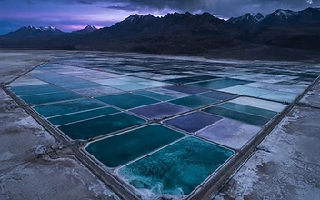
Lithium reservoirs rarely respect the lines drawn on political maps. Many of the world’s most significant brine basins and spodumene-bearing geological corridors span multiple jurisdictions, creating a unique challenge for governments and developers alike. Historically, this has led to fragmented exploration, competitive 'race-to-the-bottom' extraction strategies, and institutional hesitation. However, a new trend is emerging among resource-rich nations: the formalization of multilateral geological data-sharing agreements.
By treating the subsurface architecture of a shared mineral basin as a common informational asset, neighboring governments are moving away from zero-sum competition. This shift toward 'data-sharing sovereignty' allows for a unified, high-fidelity understanding of water tables, brine flow rates, and lithium concentration gradients across entire geological formations, regardless of which side of a border the data is collected.
The Anatomy of Collaborative Governance
Modern resource governance is no longer just about issuing mining titles; it is about managing the digital reality of the basin. Governments are now investing in shared, cloud-based geostatistical platforms where exploration data—previously held in silos—is anonymized and synthesized. This approach brings three primary benefits to the lithium industry:
- Reduced Discovery Risk: When exploration companies have access to a broader, standardized dataset, they can more accurately map the geometry of mineral deposits, reducing the capital expenditure associated with unsuccessful exploratory drilling.
- Standardized Environmental Stewardship: A unified basin-wide model allows for sophisticated predictive simulations of hydrological impact. This ensures that extraction activities on one side of a border do not inadvertently deplete the resource or degrade the environment on the other.
- Regulatory Predictability: By harmonizing data requirements, governments create a transparent, predictable administrative environment. Investors are far more likely to deploy long-term capital in regions where the geological data is reliable, accessible, and governed by a cohesive, multi-state regulatory body.
Integrating Digital Twins with State Policy
This trend is underpinned by the deployment of regional digital twins—dynamic, real-time virtual models of mineral reservoirs. When governments mandate that project-level sensor data be fed into a state-managed, basin-wide digital twin, they gain a panoramic view of mineral depletion and replenishment rates. This granular transparency empowers policy makers to move away from rigid, short-term production quotas and toward dynamic, science-based resource management that accounts for the long-term sustainability of the basin.
For the lithium industry, this represents a shift from 'uncertainty-based' project planning to 'simulation-based' development. When stakeholders have access to high-resolution, shared geological reality, the debate shifts from ownership disputes to optimized throughput and regional economic alignment.
Why it Matters
The long-term value of lithium is intrinsically linked to the stability of its supply. By fostering a culture of diplomatic data sharing, governments are building a resilient, transparent framework that de-risks the most challenging geological basins. This governance model ensures that lithium, as the primary fuel of the energy transition, is extracted not through the friction of competing jurisdictions, but through the collaborative precision of shared scientific knowledge.